GR 221- Dry- Stone Route

|
|
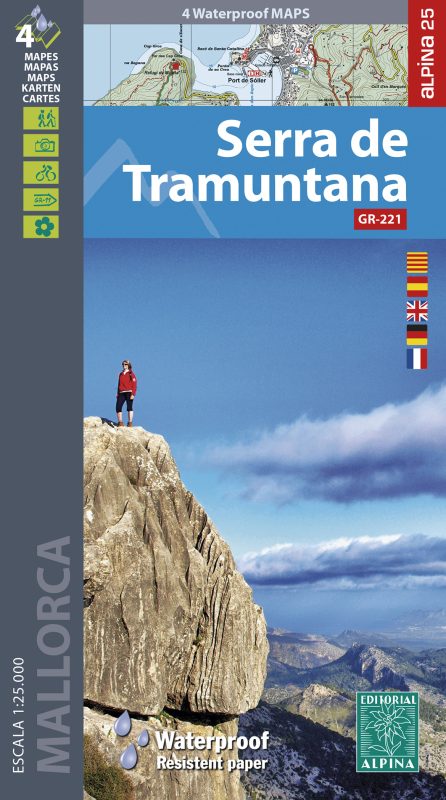
The best hiking maps for the GR 221(1:25000)
New Edition March 2024 Serra de Tramuntana Scale 1:25.000 (Tramuntana South, Central & North + Capes Formentor and Pinar) |
|---|
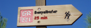
September 2023: The sections Coll de sa Gremola- Estellencs and Esporles- Valldemossa- Deià have been opened- THE GR 221 IS SIGNPOSTED BETWEEN LA TRAPA (near Sant Elm) AND PORT DE POLLENÇA
|
January 2023: The GR 221 is signposted from La Trapa to Coll de sa Gramola |
|
|---|---|
December 2022: The mountain hut Galatzó (Es Capdellà) is open |
|
October 2022: The alternative section GR 221.2 Puigpunyent- Estellencs is open |
|
May 2018: The path between Raixa and Bunyola has been signposted (alternative section GR 221.5) |
|
June 2018: The alternative section GR 221.4 between the Universitat de les Illes Balears and the GR 221 in Esporles has been signposted |
|
December 2016: The hut Coma d'en Vidal has been opened but only for groups. On 2024 it isn't still open for individual hikers |
|
2013- 2015: some stages of the GR 222 have been signposted (Coll des Racó (near Artà) to Cala Torta and Colònia de Sant Pere to Can Picafort and Son Serra
|
In this website you will find more information about the long-distance trail GR 221: |
 |
|---|
|
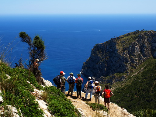
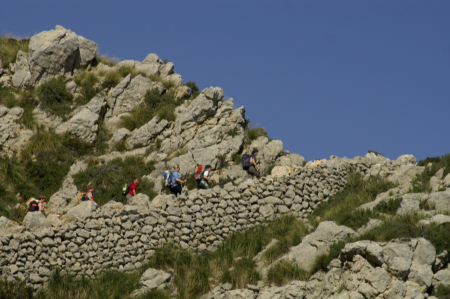
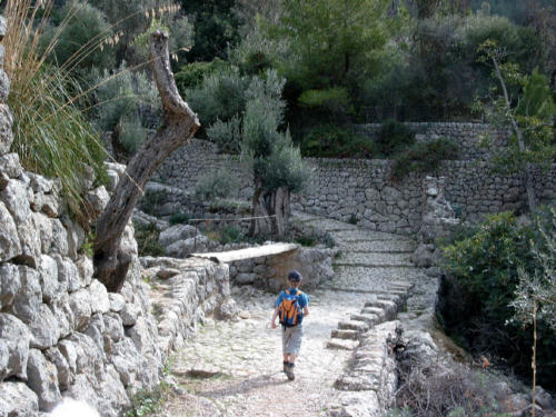
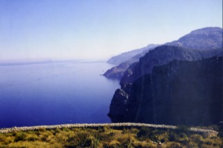
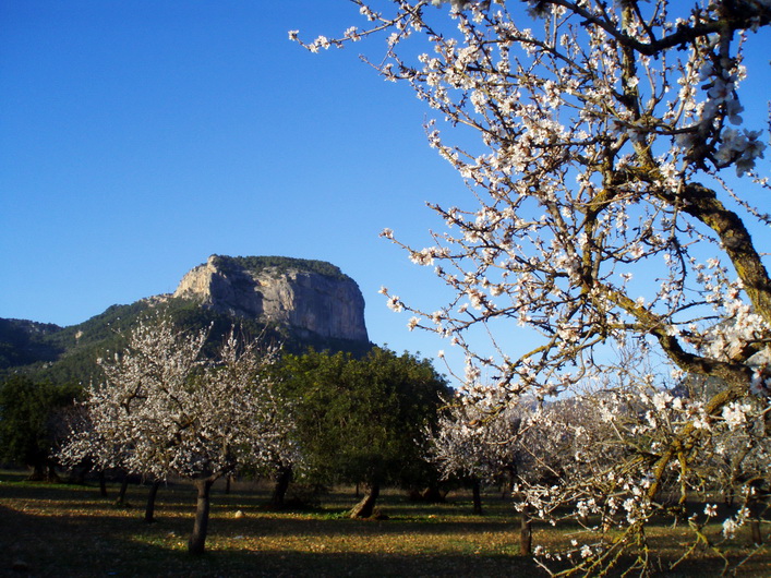
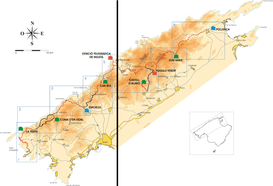
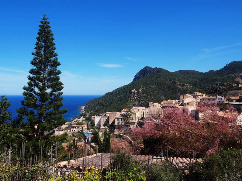
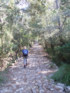
THE DRY-STONE ROUTE (GR 221) ☻ The GR 221 is the ‘Ruta de pedra en sec’, as much of the route takes advantage of the old cobbled paths (which communicated the villages and the estates on the Serra) and also because the most emblematic landscape is the rows of olive trees on terraces with dry-stone walls. The GR (173 km) will cross the Serra de Tramuntana from the Port d’Andratx (in the south of the island) to Pollença (in the north) and some buildings have been restored as mountain hostels. Some alternative sections (129 km) have been planed which will go by way of Peguera, Es Capdellà, Castell d’Alaró, Bunyola and Cala Tuent. The work restoring the paths and the buildings is being carried out by the Department of the Environment of the Consell Insular de Mallorca.The sections opened follow public paths and cross public land, but the fact that most of the Serra is private property will delay the opening of some sections. It is planned as 8 stages with a mountain hostel at the end of each |
|
|---|
STAGES
1ª Port d’Andratx- Sant Elm- La Trapa, 3h 45’ 2ª La Trapa- Estellencs, 7h 15’ 3ª Estellencs- Esporles, 5h 4ª Esporles- Deià (Refugi de Can Boi), 6h 30' 5ª Deià- Port de Sóller, 3h 15’ 6ª Port de Sóller- Ref.de Tossals, 8h 7ª Ref. de Tossals Verds- Lluc, 6h 8ª Lluc- Pollença (Refugi del Pont Romà), 4h 45’ |
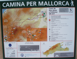
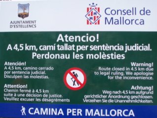
☻The opened sections cross public lands and use public trails, but 10% of the planned route cross private lands. On their initial approach, the government will try to reach an agreement with the owners. If they don't accept, the new law on long-distance trails will permit a compulsory purchase order On december 2023, the GR was completely signposted from La Trapa (near Sant Elm) and Port de Pollença with some mountain huts. It is advisable to have the maps Alpina Mallorca (1:25.000): ‘Tramuntana Nord ‘, „Tramuntana Central’ and ‘Tramuntana Sud’, included in the set of maps "Serra de Tramuntana".
|
|---|
THE FOOTPATHS IN MALLORCA..... Mallorca has a huge trail network: some of the trails were built during the time of the Arabs (902-1229), other trails cross the forests to places where charcoal was produced, others lead to inaccessible places on the coast. These were built by tobacco- smugglers around 1920 or for the watchtowers against pirates (built in the 16th century). Around Valldemossa the Austrian Archduke Lluis Salvador also built panoramic trails. |
 |
|---|
|
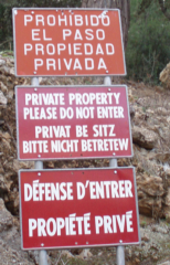
..........AND THEIR PROBLEMS ☻ A big problem is private trails being closed. 92% of the mountain range "Serra de Tramuntana" is private property. Free access is only possible on public land and on public trails. And even in these, some owners don´t recognize free access and apply to the courts to close public trails.
|
|
|---|