![]()
|
 |
These pages are not substitute for the use of guidebooks and maps for the hikes. ______________________ To ensure you have a safe hike and enjoy the GR and its landscapes, use the Alpina maps and guides
|
 |
STAGES
|
|
|
Signposted
Signposted Signposted Signposted Signposted
|
|
|---|
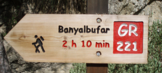
Port d'Andratx- Sant Elm- La Trapa Time: 3h 45min Height: ↑ 600 m, ↓ 330 m Degree of difficulty: medium Signposted |
|---|
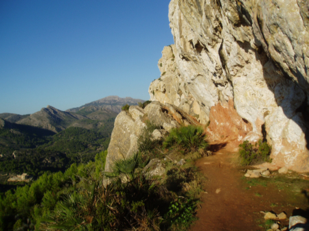
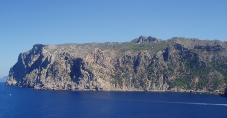
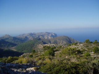
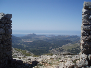
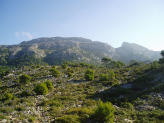
(1) Pas Vermell between Port d'Andratx and Estellencs. At his left: The flat top of Mola de s'Esclop (Stage 2)
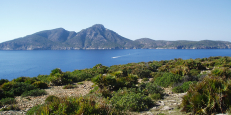
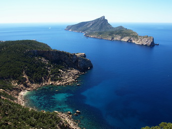
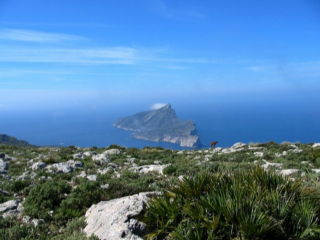
(2) Near Sant Elm: the island of sa Dragonera
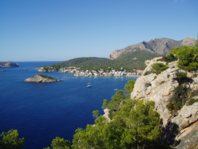
Sant Elm
(5) La Trapa, end of stage 1, from Sa Dragonera
(6) La Trapa and Sa Dragonera |
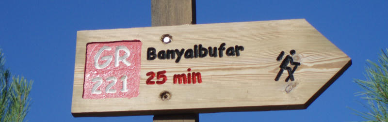
Excerpt from the stage _____________________________________________ Port d’Andratx- Sant Elm (2h 30min): On the right side of the Port d’Andratx, 100 meters before the Club de Vela, take the carrer Aldea Blanca. Go 200 meters, turn to the left on Carrer de Cala d’Egos which turns into an earth track and reach the pass (30’) and the telecommunication tower (30'). After a couple of minutes, take a footpath which climbs to a pass (dir N, 2’), go down for 10 min (picture 1) and reach an earth track. Turn left (the alternative section A- ‘S'Arracó’ starts to the right) and keep on the main track for 15 minutes. After a steep descent (pictures 2,3) take the track to the right to Sant Elm (30'). Sant Elm- La Trapa (1h 15min): From the beach go to the Plaça de Mossen Sebastià Grau (Bar Es Molí). Take the road Avinguda de la Trapa which turns into an earth track (Camí de Can Tomeví) and after 10', reach the house of Can Tomeví. With the house to your right, keep straight ahead walking on a footpath, cross a track (5') and climb steeply across the forest to a pass (40'). Go down to La Trapa (5', pictures 4, 5, 6, 7).
(3) Sa Dragonera from La Trapa
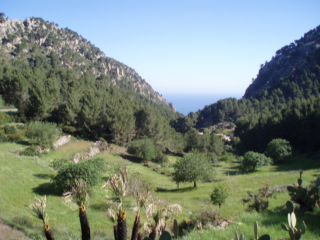
(4) La Trapa
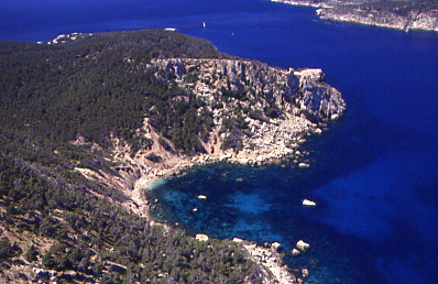
(7) Cala en Basset from La Trapa |
|---|
La Trapa- Coll de Sa Gremola- Estellencs Time: 7h 15min Height: ↑ 800 m, ↓ 920 m Degree of difficulty: medium-high The route is signposted
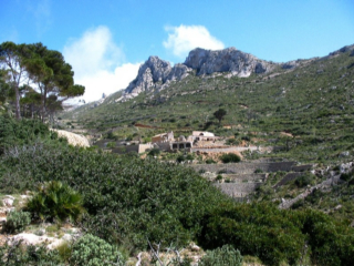
Along the way, you'll find the private mountain hut of Ses Fontanelles.
|
|---|
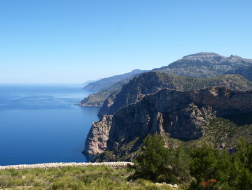
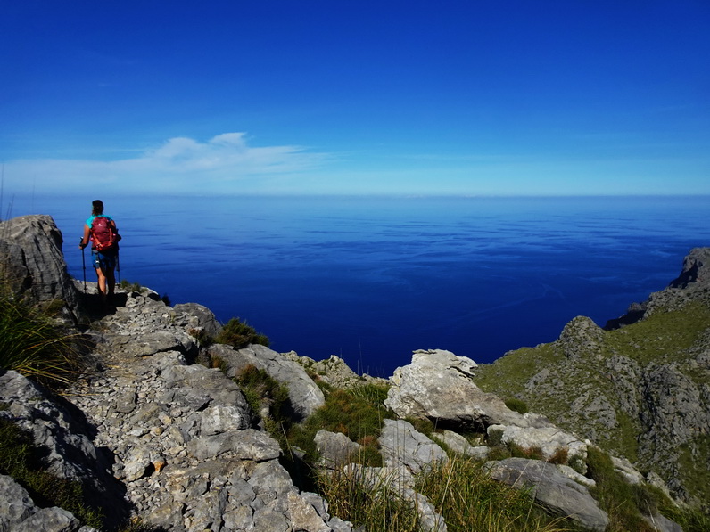
(1) Sa Dragonera from Punta Fabioler
(2) Ses Basses: View to the north
(3) Coma des Cellers
(4) From Pas Gran: View to the south
(6) From Ses Alquerioles to the south (Punta Fabioler)
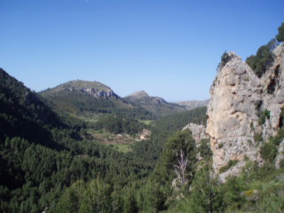
(7) Mola de S'Esclop (928m), East side
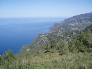
(8) The Estellencs'coast from Coma d'en Vidal |
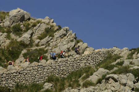
Excerpt from the stage ___________________________________________ La Trapa- Coll de sa Gremola (1h 45min): Go up on the dirt track to a sharp bend to the right and take the footpath to the left (NE, 5'). Near the Cape Punta Fabioler (20', picture 1) the path veers to the right (picture 2) until a fork (20') where you can take each of the 2 paths (the left one is more interesting) which reach an earth track (10') to the Coll de sa Gremola (45')
Coll de sa Gremola- Refugi de sa Coma d’en Vidal (4h 15min): Follow the road Ma-10 to the left for 1600m (20') till you turn right (km. 104,4- Coma des Cellers). Take a track (picture 3) to its end where a narrow path veers left to a wide ridge (15', picture 4). Watch carefully for the cairns (picture 5,6), cross two stiles and climb to the key point Pas d’en Ponsa (10’). After it, the path veers right (dir. SE, first, and afterwards E) to reach a threshing floor. The GR goes down from the threshing floor to the left (N) to the dry source of Font des Quer (10’) and on to a pass (5’). Cross the wall and turn left diagonally to another threshing floor (5', picture 6). The overgrown footpath drops down for 10 min (dir N) and reaches a wall (start of the alternative section B). Go over it to the left, take the narrow track downhill and reach the mountain hostel ‘Refugi de sa Coma d’en Vidal (15’)
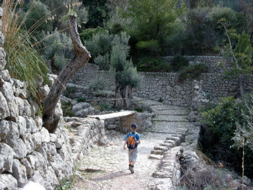
Refugi de sa Coma d’en Vidal- Estellencs (1h 15min): Follow the flat earth track which quickly zigzags down (picture 7) to a water tank (30') and a junction. Turn left and before reaching the road (10', after a paved bend), go to the right and take a narrow track. Cross the road (5'), go through the forest, look for a track (5') and turn right. After 10min, walk on the road again which you follow till the km. 95,6 where you turn left to Estellencs (20’).
(5) Mola de s'Esclop, between Pas Gran and Ses Alquerioles
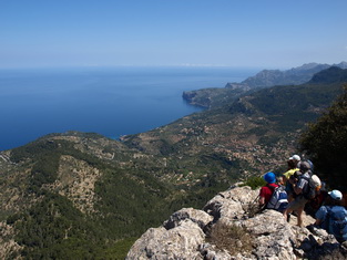
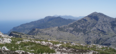
From S'Esclop summit, view to the north: Galatzó, Planícia, Puig Major and Massanella |
|---|